
Map Moore Postal Coverage
ZIP 73160 is the verified operational mailing anchor for Moore. The available official sources do not provide an address-by-address postal boundary list for every Moore street. Nearby Oklahoma City and Norman ZIPs appear in USPS or Census context, but those references do not prove that a particular Moore address uses them. The table separates a verified mailing anchor from nearby geography so the directory does not overstate its coverage.
| ZIP | Verified geographic context | Post office reference | Research note |
|---|---|---|---|
| 73160 | Moore mailing anchor; Census ZCTA context | Moore Post Office | Confirmed postal anchor, not an exact city-limit boundary. |
| 73170 | Nearby Oklahoma City delivery alternative | USPS nearby-location list | Not verified as serving Moore proper. |
| 73159 | Nearby Oklahoma City delivery alternative | USPS nearby-location list | Not verified as serving Moore proper. |
| 73129 | Nearby Oklahoma City delivery alternative | USPS nearby-location list | Not verified as serving Moore proper. |
| 73069 / 73071 / 73072 | Nearby Norman-area ZCTA context | Census profile and Norman USPS area | Context only, not evidence for a Moore street. |
Use a USPS address result to determine the mailing ZIP for one address. Use the city-limit map or parcel services separately when the question is whether the address is inside Moore.
Use Moore's 73160 Postal Anchor
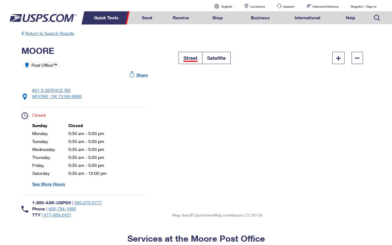
The official USPS Moore Post Office result lists 601 S Service Rd, Moore, OK 73160-9998, with a phone number of 405-794-1690. The published retail hours are Monday through Friday, 8:30 to 5, and Saturday, 8:30 to noon. That location is a useful Moore postal anchor, but its nearby-location list is not a full delivery-boundary map.
Review the USPS Moore Post Office location result before treating 73160 as a city-wide boundary.
For a person, street, or parcel question, run the exact street address through the USPS address workflow and preserve the returned city and ZIP pair. A post office result alone does not establish every delivery address around it. Census material associates Moore with ZCTA 73160, but a ZCTA is a statistical geography, not a set of deliverable street addresses. Nearby ZCTAs for Norman provide context only. They should never replace the address-specific USPS result.
Narrow Moore ZIP Parcels
Cleveland County Spatialest can assist a ZIP-oriented parcel sweep, although the inspected interface did not reliably expose a dedicated ZIP field. Its city or municipality and other geography filters can narrow a search after USPS confirms an exact address. That makes the tool a parcel-context step, not a way to produce a complete postal list.
| Portal field | Field type | Required | ZIP-oriented use |
|---|---|---|---|
| City / municipality | Advanced filter | Not stated | Limits a countywide property search to Moore-oriented parcel context. |
| Property address | Text | Not stated | Checks a specific USPS-verified street address. |
| Subdivision | Advanced filter | Not stated | Helps compare an addition or plat with parcel geography. |
| Township / range / section | Legal-geography fields | Not stated | Useful near an edge or where the address is incomplete. |
| Tax district | Advanced filter | Not stated | Separates a tax-geography question from a postal question. |
| Dedicated ZIP field | Not reliably exposed | Not applicable | Verify the mailing ZIP with USPS rather than inferring it here. |
The assessor detail view can show ownership, mailing and physical descriptions, legal description, value, sales, deeds, tax bills, and maps. Those fields are useful for a parcel record, but they are not substitutes for a postal delivery result.
Check Moore ZIP Code Fields
The City of Moore NG911 FeatureServer adds left and right ZIP and post-community fields to a road-centerline record. It also includes city and county values, ESN, PSAP, road class, address ranges, and alternate or legacy road fields. Service values include CLEVELAND COUNTY, MOORE, ESN 34, and MOORE 911.
Those are valuable cross-check fields when the question concerns address ranges or emergency-response geography. A null ZIP field is a data condition, not permission to fill it with a nearby value. A post-community entry is also not a mailing guarantee.
Use a Moore ZIP Code Search
A ZIP can narrow the geography, but it does not create a complete public list of people. Start with an address that has been verified for mail delivery, then use the appropriate map or parcel system for the next question. The state voter portal is an individual registration-verification service, not a ZIP-wide enumeration tool.
- Check the full street address in USPS and record the returned mailing city and ZIP.
- Use Spatialest with property address, city or municipality, subdivision, or legal-geography fields to find the parcel context. Do not infer a postal ZIP from its parcel result.
- Compare the address range in Moore NG911 and the City or county GIS layers. Note the ZIP left and right values only as addressing-data evidence.
- Use the Cleveland County Election Board maps for the valid address's precinct and Moore ward. Those boundaries are different from postal delivery areas.
- After the parcel is identified, use the Moore street directory for the address-to-parcel and legal-description workflow.
For an individual registration check, the OK Voter Portal requires first name, last name, and date of birth as registered. The Election Data Warehouse has an eligibility-controlled request process for registration and voter-history files. Its request form includes the requester's ZIP, but the research does not establish it as a public ZIP-filtered resident search.
Compare Moore Boundary Overlays
Moore's postal, tax, city-limit, emergency-response, precinct, ward, school, and technology-district lines can differ. The City Council says ward assignment is address-based. The Cleveland County Election Board's maps supply precinct and Moore Ward context. Cleveland County GIS can overlay parcels, neighborhoods, roads, and tax geography.
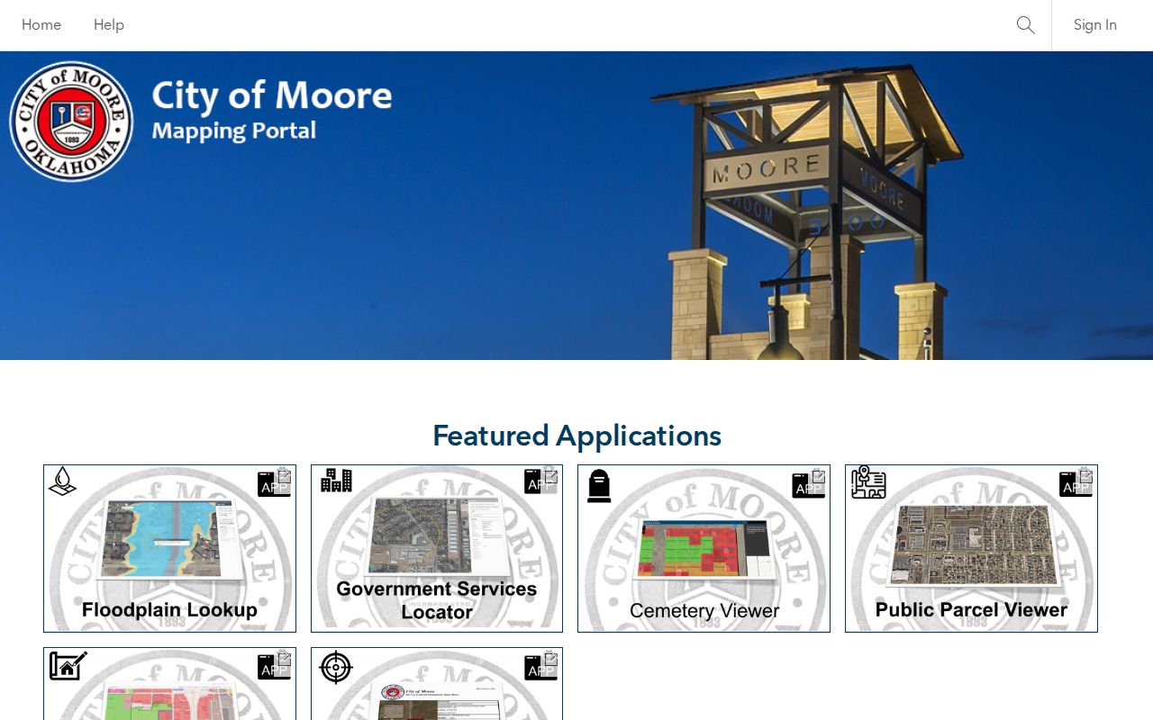
Open the City of Moore GIS viewer to compare a road and parcel layer after USPS returns the mailing result.
Moore's directional grid also matters when checking a location. I-35, US 77, Santa Fe, Telephone Road, Broadway, and Main can orient a search, but the full prefix and street suffix remain essential.
Keep a compact location note for each result instead of combining several systems into one label. The postal result should preserve the ZIP and USPS preferred city. The local record should separately retain the incorporated municipality, county, parcel or account identifier, subdivision, precinct, ward, NG911 post community, and NG911 ZIP left and right values. Add a source date to every field group because a live portal can change after a map or record is saved.
| Location field | Best source | What it answers |
|---|---|---|
| Mailing city and ZIP | USPS address workflow | How the address should be used for delivery. |
| Incorporated municipality | ODOT city map or City of Moore material | Whether the location is within the city boundary. |
| Parcel and subdivision | Spatialest and county GIS | The property and tax-geography relationship. |
| Ward and precinct | City Council and Election Board maps | The address-based civic districts. |
| Road-range ZIP and post community | Moore NG911 FeatureServer | Emergency-addressing context, subject to null fields. |
This field discipline is especially important near the Oklahoma City and Norman edges, where a nearby geography may appear relevant without establishing the correct mailing or municipal result for a particular street.
Separate Moore ZIP Code Boundaries
Moore covers about 21.9 square miles in Census profile geography, while 73160 is a postal anchor and a ZCTA reference point. Neither fact makes a ZCTA or ZIP boundary the same thing as an incorporated city boundary. The April 20, 2026 ODOT city map shows roads and city limits, and it should be consulted separately from the USPS address result.
Choose the source by question. USPS answers what belongs on an envelope. Census ZCTA material supports statistical geography. The NG911 service helps classify a road range or response jurisdiction. Spatialest and county GIS help with a parcel, tax geography, adjacent lots, or a named subdivision. Election Board maps connect a valid address to a precinct and Moore ward. A clear record trail can retain all of these values without pretending that one boundary governs the rest.
When the values do not agree, write down the source, access date, and what it measures. For example, a road centerline may have a ZIP left or right value while a parcel view shows a tax boundary and USPS returns the delivery pair. That is a documented geographic difference, not a basis for changing one source to fit another.
Define Moore ZIP Code Terms
These labels keep a postal result from being confused with a parcel or municipal boundary.
- Base ZIP
- A Postal Service delivery geography used to route mail, not a city-limit or parcel-boundary label.
- ZIP+4
- An added four-digit segment that further sorts mail within a base ZIP. It does not replace the base ZIP for geographic comparison.
- PO-box ZIP
- A ZIP assigned for post-office-box delivery. It should not be assumed to describe surrounding street delivery.
- Unique ZIP
- A ZIP assigned to one organization or large recipient. None was verified for Moore in the available research.
- Carrier route
- A mail-delivery route within a postal area. It is not an incorporated-boundary line or a public resident list.
Respect Moore ZIP Directory Limits
The Moore ZIP code directory is a geography reference, not a complete people directory. USPS, Census ZCTA, NG911, assessor, GIS, ward, and precinct sources each answer a distinct question. A missing or different value may reflect the type of boundary being measured. Verify a mailing ZIP with USPS, a parcel relationship with the Assessor or GIS, and city status with the current city-limit source.
Use public address information for lawful, personal research, and do not use it to stalk, harass, or harm anyone.